
Florida flooding, November 2026: where it flooded and what to do now.
A slow storm parked over the Space Coast and Volusia County from Nov. 17 to 20 dropped more than 19 inches of rain in places, two weeks after a record rain flooded southern Brevard. The St. Johns River is in major flood at Cocoa. Below: a map of every neighborhood reported flooded, rain totals, where to report damage, and what to do once the water is out of your house.
If you are in danger or trapped by water, call 911. For shelters and storm information, dial 2-1-1.
- areas mapped from news and county reports
- 59
- areas mapped from news and county reports
- with water reported in homes
- 29
- with water reported in homes
- most rain, Nov. 17-20 (Port Canaveral)
- 19.47"
- most rain, Nov. 17-20 (Port Canaveral)
- St. Johns River near Cocoa (major flood: 17 ft)
- 18.75 ft
- St. Johns River near Cocoa (major flood: 17 ft)
Map: where homes flooded, rain totals and FEMA flood zones
Tap a dot for what was reported there and the source. Use the layer button (top right of the map) to switch layers on and off. Zoom in to street level to see FEMA's flood zones under your neighborhood.
Dots mark the general area named in news and county reports, not individual homes. FEMA zones show mapped flood risk, not where water went this month, and a home outside a high-risk zone can still flood.
Neighborhoods and areas reported flooded
59 areas from news and county reports, 29 with water reported in homes. Each one links to its source.
Showing all 59
Brevard County (27)Brevard County flood page →
- Palm Bay Estates (55+ mobile home community), Palm Bay · Nov. 19Evacuation ordered or urged. Mandatory evacuation for about 65 homes west of the canal and east of the railroad; police and fire moved residents out by boat. The community's access road also washed out on Nov. 2. (WFTV) · Nov. 17-20 storm
- Fiske Blvd near Anderson Elementary, Rockledge · Nov. 19Homes reported flooded. Water reported entering homes. News 6 video that evening showed water at mailbox height across the Green Acres neighborhood off Fiske Blvd, some homes dark and empty, and a sheriff's high-water vehicle in the area. (WFTV) · Nov. 17-20 storm
- Pineland Drive, Rockledge · Nov. 19Homes reported flooded. More than 2 feet of water on the road; a resident said wakes from passing cars pushed water into lower homes. (FOX 35) · Nov. 17-20 storm
- Woodsmere, Rockledge · Nov. 19Street and yard flooding reported. Neighborhood entrance and streets underwater. (Florida Today) · Nov. 17-20 storm
- Huntington Lane neighborhood, Rockledge · Nov. 20High-water rescues. Road closed to drivers with a whole neighborhood cut off behind the barricades; a neighbor was taken out by canoe and said water reached mailboxes. National Guard vehicles were bringing people out. (News 6) · Nov. 17-20 storm
- Catalina Village, off Burnett Rd, West Cocoa · Nov. 19Homes reported flooded. St. Johns River water forced residents out of their homes. (WFTV) · Nov. 17-20 storm
Volusia County (11)Volusia County flood page →
- Florida Shores, Edgewater · Nov. 19-20Homes reported flooded. Emergency workers reported about 20 homes with water inside in one neighborhood on Nov. 20, up from a preliminary count of four; crews went door to door and took families out by boat. The city declared a state of emergency. (WFTV) · Nov. 17-20 storm
- Corbin Park, New Smyrna Beach · Nov. 19-20Homes reported flooded. Among the city's worst flooding, with water entering homes. A fallen tree dropped power lines into the floodwater and transformers were submerged; the city later said the electrical hazard was resolved. New Smyrna Beach declared a local emergency after 9.5 inches of rain in three days. (NTD, citing the City of New Smyrna Beach) · Nov. 17-20 storm
- Glencoe Road area, New Smyrna Beach · Nov. 19-20Homes reported flooded. Water entered homes along Glencoe Road, per the city. Many requests for help also came from south of SR 44 outside the city, including Whispering Pines and near Old Mission Road. (NTD, citing the City of New Smyrna Beach) · Nov. 17-20 storm
- Dame Street area, Port Orange · Nov. 19Homes reported flooded. Knee- to waist-deep water; one home had about 4 inches inside and a foot in the garage. (FOX 35) · Nov. 17-20 storm
- Moonstone Ct and Colony in the Wood area, Port Orange · Nov. 18-19Street and yard flooding reported. Streets and parking lots flooded; Port Orange declared a local emergency. (WESH) · Nov. 17-20 storm
- Lantern Park (Lantern Dr), South Daytona · Nov. 18Street and yard flooding reported. A foot or more of water on the street. (WESH) · Nov. 17-20 storm
Seminole County (2)Seminole County flood page →
- Lake Harney Rd area near Geneva, Geneva · Nov. 19Evacuation ordered or urged. Lake Harney at major flood stage and water starting to enter homes; voluntary evacuation advised for low-lying areas along the St. Johns. SR 46 closed at the river. (News 6) · Nov. 17-20 storm
- Mullet Lake Park Rd at Shady Lane, Geneva · Nov. 20Street and yard flooding reported. Road flooded from Shady Lane Park to Mullet Lake Park as Mullet Lake and the St. Johns rose. Seminole County said voluntary evacuations were underway along the river and more than 40 roads were closed. (Oviedo Community News) · Nov. 17-20 storm
Orange County (3)Orange County flood page →
- E Colonial Dr (SR 50), Sable Palm Dr to Fort Christmas Rd, Christmas · Nov. 19-20Street and yard flooding reported. Closed in both directions by flooding from about noon Nov. 19; still listed closed the morning of Nov. 20. Floodwater also raced over Christmas Rd near SR 50. (WFTV) · Nov. 17-20 storm
- Fort Christmas Rd at Reindeer Rd, Christmas · Nov. 20Street and yard flooding reported. Road closed by flooding. (WESH) · Nov. 17-20 storm
- E Colonial Dr at Chuluota Rd, Bithlo · Nov. 19Street and yard flooding reported. Flooded late morning Nov. 19, per FDOT. (Central Florida Public Media) · Nov. 17-20 storm
Flagler County (1)
- South end: S 25th St and S Flagler Ave area, Flagler Beach · Nov. 20Homes reported flooded. Water got into homes in the south end, with more than 12 inches on the roads; two garages on Lambert Ave also took water. Palm Coast declared a local emergency, and the county said it had no reports of flooded homes in Palm Coast. (FlaglerLive (City of Flagler Beach)) · Nov. 17-20 storm
Broward County (7)
- La Vue at Emerald Pointe Apartments (Sheridan St and NW 40th Ave area), Hollywood · Nov. 18Homes reported flooded. Knee-deep water inside ground-floor units after nearby lakes overflowed; FWC officers rescued more than 70 residents and 20 to 30 pets. (CBS News Miami) · Nov. 17-20 storm
- N 72nd Ave and Duval St area (Driftwood), Hollywood · Nov. 18Homes reported flooded. Floodwater reached front doors and went inside homes; one resident of 19 years said it was the first time his house flooded. Hollywood declared a state of emergency. (WSVN 7News) · Nov. 17-20 storm
- Edgewood (Marina Blvd and SW 14th Ave area), Fort Lauderdale · Nov. 17-19Homes reported flooded. A resident reported about 2 feet of water inside her home overnight, one of several Fort Lauderdale neighborhoods with extensive flooding. (WSVN 7News) · Nov. 17-20 storm
- Melrose Park and Melrose Manors, Fort Lauderdale · Nov. 18-19Street and yard flooding reported. Residents woke up trapped in their homes by standing water; city crews were still pumping with vacuum trucks on Nov. 19. (CBS News Miami) · Nov. 17-20 storm
- Neighborhoods off Stirling Rd near SW 40th Ave, Dania Beach · Nov. 18-19Street and yard flooding reported. Residents stranded in their homes for two days by standing water that reached the back doors of some homes. (CBS News Miami) · Nov. 17-20 storm
- NW 11th Place neighborhood, Plantation · Nov. 18Street and yard flooding reported. Deep floodwater lasted through Nov. 18; water got into at least one garage and still surrounded homes. (WSVN 7News) · Nov. 17-20 storm
St. Lucie County (2)
- Vitalia, Port St. Lucie · Nov. 3-8High-water rescues. Residents stranded for days; swamp-buggy evacuations. (CBS12) · Nov. 1-2 storm
- Raintree Forest / White City (S. 25th St and Bell Ave), Fort Pierce · Nov. 1-3Homes reported flooded. A couple and their dog were rescued by airboat after water entered their home; other homes on those streets flooded. St. Lucie County logged 472 damage reports, 421 residential. (TCPalm) · Nov. 1-2 storm
Martin County (2)
- Hyline Dr and Tick Ridge area, Jensen Beach · Nov. 1-8Homes reported flooded. 66 homes flooded and 25 destroyed in the Hyline/Tick Ridge area, with stormwater and septic overflow; some homes still surrounded by water a week later. (TCPalm) · Nov. 1-2 storm
- NE Cheri Dr, Jensen Beach · Nov. 1-3Homes reported flooded. A family's home was gutted after the flood. (TCPalm) · Nov. 1-2 storm
Palm Beach County (4)
- Lone Pine Estates and Canterbury, Riviera Beach · Nov. 2Homes reported flooded. Streets submerged and sewer backups into some homes; fire rescue evacuated 71 people in Riviera Beach. (CBS12) · Nov. 1-2 storm
- Century Village, West Palm Beach area · Nov. 1High-water rescues. Water 3 to 4 feet deep in spots; nearly 100 people trapped in vehicles. (WPTV) · Nov. 1-2 storm
- Foxhall community, West Palm Beach · Nov. 1-3Homes reported flooded. Residents reported water inside, one with water through the kitchen and bedrooms who was stranded at home. (WPBF) · Nov. 1-2 storm
- Briar Bay, West Palm Beach · Nov. 1-9Street and yard flooding reported. Residents stuck for more than a week as pumps failed. (CBS12) · Nov. 1-2 storm
Hardest-hit areas this week
- Brevard County. Upgraded to a rare Level 4 of 4 high risk for flash flooding on Nov. 19. The sheriff reported almost 100 high-water rescues that day. Palm Bay ordered about 65 homes in Palm Bay Estates to evacuate. Merritt Island, Port Canaveral, Cocoa and Titusville took the most rain.
- Volusia County. Daytona Beach, Port Orange, Ponce Inlet and Oak Hill took 12 to 14+ inches. Daytona Beach, New Smyrna Beach, Port Orange and Ponce Inlet declared local emergencies, and New Smyrna Beach said water entered homes in Corbin Park and along Glencoe Road.
- St. Johns River. Seminole County asked low-lying homes along the river to leave voluntarily, and SR 46 closed at the river. Lake Harney reached major flood stage, and the NWS forecast the river near Sanford to reach major flood (8 ft) by about Nov. 25.
- Broward County. The same storm hit first: more than 15 inches fell in parts of Broward on Nov. 17-18. FWC officers rescued more than 70 residents from a flooded apartment complex in Hollywood, water got into homes in Hollywood and Fort Lauderdale's Edgewood neighborhood, and Broward schools stay closed until Nov. 30.
- Orange County. East Colonial Drive (SR 50) closed near Christmas, which took 17.72 inches, and the St. Johns River gauge above Christmas passed its Hurricane Ian record. No home flooding had been reported there as of Nov. 20. Orange County flooding.
- Schools. Brevard and Volusia schools closed Nov. 19-20 and return Nov. 30. Flagler schools closed Nov. 20.
St. Johns River near Cocoa (SR 520): 18.75 ft at 3:15 p.m. Nov. 20, a record: major flood (major stage 17 ft). Forecast 18.8 ft by Nov. 21.St. Johns River near Sanford (Lake Monroe): 6.68 ft at 3:30 p.m. Nov. 20: minor flood. Forecast 8 ft, major flood stage, by about Nov. 25.St. Johns River above Christmas (SR 50): 12.48 ft at 3:30 p.m. Nov. 20 and rising, above this gauge's 11.66 ft record from Hurricane Ian in 2022 (provisional data). NWS sets no flood stages or forecast for this gauge.St. Johns River above Lake Harney (Geneva): 11.49 ft at 3:30 p.m. Nov. 20: major flood (major stage 10 ft). Forecast 13 ft by the evening of Nov. 22.
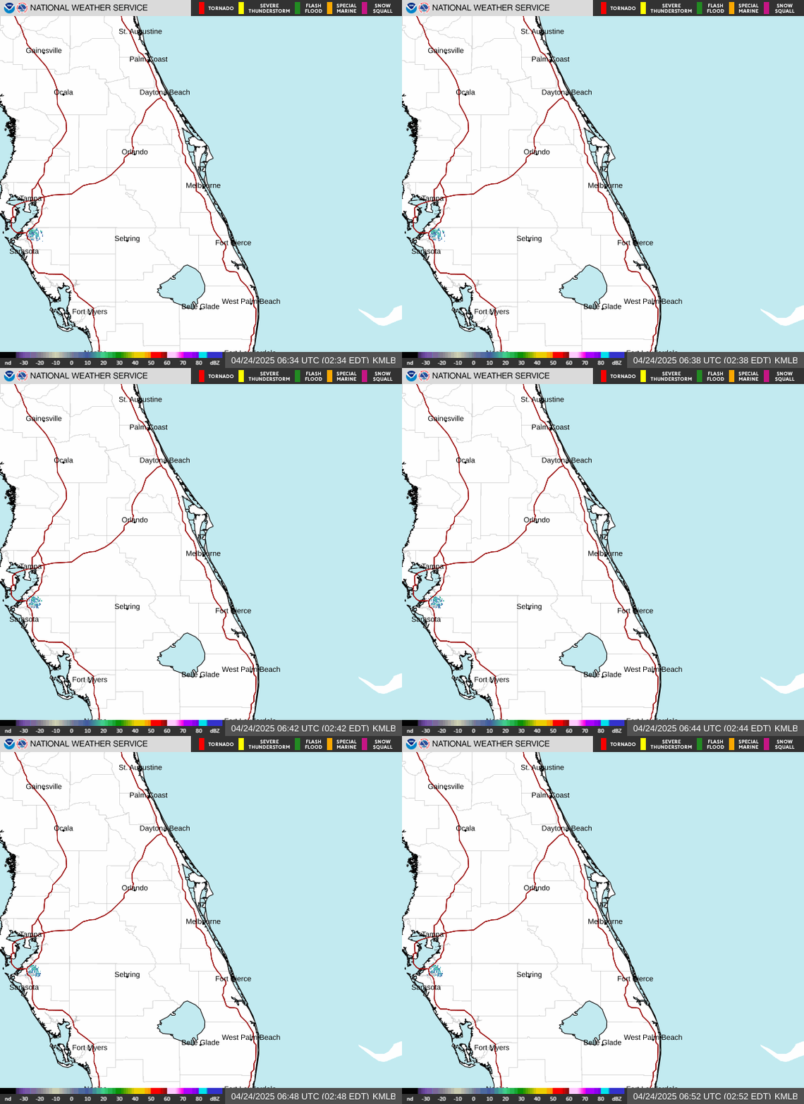
Updates automatically from the National Weather Service. Forecasters expected 6 to 10 more inches on parts of the coast through Nov. 21.
How much rain fell
| Location | County | Inches |
|---|---|---|
| Port Canaveral | Brevard | 19.47 |
| Christmas | Orange | 17.72 |
| Merritt Island | Brevard | 17.07 |
| Daytona Beach | Volusia | 14.39 |
| Ponce Inlet | Volusia | 13.53 |
| Oak Hill | Volusia | 12.81 |
| Ocoee | Orange | 12.66 |
| Pineda | Brevard | 12.14 |
| Port Orange | Volusia | 11.99 |
| Lake Harney | Seminole | 7.65 |
| Flagler Airport | Flagler | 7.02 |
Preliminary totals; rain was still falling when they were posted.
| Grant-Valkaria | 23.69" |
| Malabar | 23.44" |
| Palm Bay | 19.75" |
| Melbourne Beach | 13.88" |
| Melbourne | 13.11" |
That storm brought a state of emergency (now 21 counties under EO 26-232), and more than 2,000 Brevard residents reported flooding in their homes by Nov. 4. More on that storm: Brevard flood, November 2026: what to do now.
What to do once the water goes down, in order
- Go back in safely. Keep power off to flooded rooms until an electrician or your utility says it is safe. Wear gloves, boots and an N-95: floodwater carries sewage and chemicals. See power, gas and CO safety.
- Photograph everything before it goes to the curb. Every room, inside cabinets and closets, and the water line on the walls. See what to keep and what to toss.
- Report the damage to your county. Use the Brevard or Volusia form below. It is not an aid application, but any federal help depends on the count of damaged homes.
- Call your flood insurer. Homeowners policies exclude rising water. If you have an NFIP or private flood policy, report the loss now; you do not need to wait for a disaster declaration.
- Get wet material out and dry the structure. Wet drywall, insulation, carpet and pad generally have to come out. Fans alone will not dry wall cavities in Florida humidity, and a house still wet after 24 to 48 hours should be assumed to have mold. See flood damage cleanup and the drying process.
- Check who you hire. Out-of-area crews arrive after every flood. Look up the license in the Florida DBPR license search and get the estimate in writing. See how to read a restoration estimate.
You pay CFDR nothing, and CFDR does not bill your insurer. CFDR is a referral service, not FEMA and not a contractor; the company inspects, does the work and contracts with you directly.
Damage reports, shelters, roads and river gauges
- Walter Butler Community Center, 4201 N. Cocoa Blvd., Cocoa (pets and special needs accepted)
- Joseph N. Davis Community Center, 2547 Bruce D. Buggs St., Melbourne (Red Cross)
- LifePointe Ministries, 4220 S. Hopkins Ave., Titusville
Shelters open and close quickly. Confirm with 2-1-1 before you go.
Florida flooding questions
Where is it flooding in Florida right now?+
As of Nov. 20, 2026, the worst flooding is along the east-central Atlantic coast: Brevard County (Merritt Island, Port Canaveral, Cocoa, Titusville, Palm Bay) and Volusia County (Daytona Beach, Port Orange, Ponce Inlet, New Smyrna Beach, Edgewater). Earlier in the same storm, on Nov. 17-18, more than 15 inches fell in parts of Broward County, flooding homes in Hollywood and Fort Lauderdale. The St. Johns River is in major flood at Cocoa and above Lake Harney, and forecast to reach major flood near Sanford by about Nov. 25. Check FL511 and your county emergency page before you drive.
How much rain fell?+
WESH reported 72-hour totals through 6:21 a.m. Nov. 20 of 19.47 inches at Port Canaveral, 17.72 inches at Christmas, 17.07 inches on Merritt Island and 14.39 inches in Daytona Beach. Earlier, on Nov. 1-2, NWS Melbourne's preliminary totals reached 23.69 inches in Grant-Valkaria.
Which counties are under a state of emergency?+
Executive Order 26-232, signed Nov. 18, 2026, covers 21 counties: Brevard, Broward, DeSoto, Duval, Flagler, Glades, Hardee, Hendry, Highlands, Indian River, Lake, Martin, Miami-Dade, Monroe, Okeechobee, Palm Beach, Putnam, Seminole, St. Johns, St. Lucie and Volusia. Orange County is not on the list. Titusville, Daytona Beach, New Smyrna Beach, Port Orange and Edgewater also declared local emergencies on Nov. 19, and Hollywood declared one on Nov. 18.
Is FEMA help available?+
Not yet. Florida asked on Nov. 9 for a federal Major Disaster Declaration for the Nov. 2 flooding, and as of Nov. 19 FEMA was reviewing it. File your county damage report now, because the request depends on the count of damaged homes.
Does homeowners insurance cover flood damage?+
A standard homeowners policy excludes rising floodwater. That takes a separate flood policy, usually through the NFIP or a private flood insurer. You do not need to wait for a disaster declaration to file a flood insurance claim.
How do I report flood damage to my home?+
Brevard and Volusia counties each have an online damage report form, linked in the Official help section of this page. It is not an application for aid, but it documents how many homes were hit, and any request for federal help depends on that count. Also report the loss to your flood insurer.
Where can I get sandbags?+
Volusia County lists its sandbag sites at volusia.org/sandbags. In Brevard, cities ran their own sandbag operations during the Nov. 17-20 storm; Palm Bay filled more than 10,000 bags in 48 hours by Nov. 18. Check your city's page or dial 2-1-1 for current locations.
When will the St. Johns River go down?+
Slowly. The river keeps rising for days after the rain stops. In the afternoon of Nov. 20 the National Weather Service gauge near Cocoa read a record 18.75 feet, above the 17-foot major flood stage, with a forecast of 18.8 feet. Above Lake Harney it read 11.49 feet (major flood) with a forecast of 13 feet by Nov. 22, and near Sanford it was forecast to reach 8 feet, major flood stage, by about Nov. 25. Check the live gauges linked on this page.
Is my house in a flood zone?+
Turn on the FEMA flood zones layer on the map above and zoom in to street level. Light blue is FEMA's high-risk zone (1% annual chance); tan is moderate risk (0.2%). FEMA's official maps are at msc.fema.gov. Flood zones show mapped risk, not where water went this month, and a home outside a high-risk zone can still flood.
How fast does a flooded house need to be dried out?+
Fast. A house that stays wet for more than 24 to 48 hours should be assumed to have mold. Wet drywall, insulation, carpet and pad generally have to come out, and the structure needs drying equipment and moisture readings; fans alone will not dry a wall cavity in Florida humidity.
Where did it flood in Palm Bay?+
News and county reports named these Palm Bay areas: Palm Bay Estates (55+ mobile home community) (Nov. 19): Mandatory evacuation for about 65 homes west of the canal and east of the railroad; police and fire moved residents out by boat. The community's access road also washed out on Nov. 2; Port Malabar Blvd near US 1 (Nov. 19): Road washed out again; a nearby homeowner said water reached his home; Ladner Rd NE area (Nov. 2): Homes gutted by floodwater; debris piles along the street two weeks later; Fallon Blvd NE area (Nov. 2): A canal broke through; a home flooded waist-deep and part of the road collapsed; Columbus St NE (near Fallon Blvd) (Nov. 1-3): Ankle-deep water inside a raised home, plus a failed septic system; neighbors teamed up on the cleanup; California Ave NE (Nov. 1-3): Water reached mailbox height; two weeks later homes were dark and empty, families still repairing, and debris lined the curbs; Badger Dr NE (Nov. 1-3): Several elderly residents lost everything; up to 5 feet of water in one home, with a resident rescued by canoe or kayak; Port Malabar Blvd NE at Turkey Creek (Nov. 2): Road underwater and washed out; crews reached residents by boat. Palm Bay's fire chief reported about 1,400 rescues citywide. Each one is on the map above with a link to its source.
Where did it flood in Rockledge?+
News and county reports named these Rockledge areas: Fiske Blvd near Anderson Elementary (Nov. 19): Water reported entering homes. News 6 video that evening showed water at mailbox height across the Green Acres neighborhood off Fiske Blvd, some homes dark and empty, and a sheriff's high-water vehicle in the area; Pineland Drive (Nov. 19): More than 2 feet of water on the road; a resident said wakes from passing cars pushed water into lower homes; Woodsmere (Nov. 19): Neighborhood entrance and streets underwater; Huntington Lane neighborhood (Nov. 20): Road closed to drivers with a whole neighborhood cut off behind the barricades; a neighbor was taken out by canoe and said water reached mailboxes. National Guard vehicles were bringing people out. Each one is on the map above with a link to its source.
Where did it flood in West Melbourne?+
News and county reports named these West Melbourne areas: Lamplighter Village (55+ manufactured homes) (Nov. 2-3): Parts underwater, about 1.5 feet inside one home; hundreds evacuated by airboat and boat. The sheriff named it among the worst-hit areas; Wingate (Nov. 2): Airboats took at least 7 residents from flooded homes; Hollywood Blvd corridor (Nov. 2): Police said several homes flooded; Carriage Gate (Nov. 2): Flooded streets shown in news video. Each one is on the map above with a link to its source.
Where did it flood in Daytona Beach?+
News and county reports named these Daytona Beach areas: Palm Cove Apartments, Nova Rd (Nov. 19): Residents forced out by standing water; Daytona Beach declared a local emergency; Ruby Street, Lakeside Village (Nov. 19): Nearly knee-deep water in the street; Midtown (George W. Engram Blvd and side streets) (Nov. 20): Flooding worsened Nov. 20: Engram Blvd partly submerged at Nova Rd, and Wilson Ave, Fulton St, Lincoln St and Garden St under several inches of water. Each one is on the map above with a link to its source.
Where did it flood in West Cocoa?+
News and county reports named these West Cocoa areas: Catalina Village, off Burnett Rd (Nov. 19): St. Johns River water forced residents out of their homes; Lake Poinsett area (Nov. 19-20): NWS flood statement: water enters homes along the river at 17.2 ft on the Cocoa gauge, and the river passed 18 ft. No home flooding confirmed in news reports yet. Each one is on the map above with a link to its source.
Where did it flood in Titusville?+
News and county reports named these Titusville areas: Cathedral Way and Crystal Ct area (Nov. 19): Streets impassable; Titusville declared a local emergency. Also impassable: Barna Ave at Country Club, Hemlock/Slash Pine/Hickory Lake, and DeLeon at Elizabeth and Cora; Village at Valencia apartments, S Park Ave (Nov. 20): Six residents evacuated; the city measured 24 to 30 inches of water on the road at the complex. Titusville began city-wide damage assessments Nov. 20. Each one is on the map above with a link to its source.
Where did it flood in New Smyrna Beach?+
News and county reports named these New Smyrna Beach areas: Corbin Park (Nov. 19-20): Among the city's worst flooding, with water entering homes. A fallen tree dropped power lines into the floodwater and transformers were submerged; the city later said the electrical hazard was resolved. New Smyrna Beach declared a local emergency after 9.5 inches of rain in three days; Glencoe Road area (Nov. 19-20): Water entered homes along Glencoe Road, per the city. Many requests for help also came from south of SR 44 outside the city, including Whispering Pines and near Old Mission Road. Each one is on the map above with a link to its source.
Where did it flood in Port Orange?+
News and county reports named these Port Orange areas: Dame Street area (Nov. 19): Knee- to waist-deep water; one home had about 4 inches inside and a foot in the garage; Moonstone Ct and Colony in the Wood area (Nov. 18-19): Streets and parking lots flooded; Port Orange declared a local emergency. Each one is on the map above with a link to its source.
Where did it flood in Geneva?+
News and county reports named these Geneva areas: Lake Harney Rd area near Geneva (Nov. 19): Lake Harney at major flood stage and water starting to enter homes; voluntary evacuation advised for low-lying areas along the St. Johns. SR 46 closed at the river; Mullet Lake Park Rd at Shady Lane (Nov. 20): Road flooded from Shady Lane Park to Mullet Lake Park as Mullet Lake and the St. Johns rose. Seminole County said voluntary evacuations were underway along the river and more than 40 roads were closed. Each one is on the map above with a link to its source.
Where did it flood in Christmas?+
News and county reports named these Christmas areas: E Colonial Dr (SR 50), Sable Palm Dr to Fort Christmas Rd (Nov. 19-20): Closed in both directions by flooding from about noon Nov. 19; still listed closed the morning of Nov. 20. Floodwater also raced over Christmas Rd near SR 50; Fort Christmas Rd at Reindeer Rd (Nov. 20): Road closed by flooding. Each one is on the map above with a link to its source.
Where did it flood in Hollywood?+
News and county reports named these Hollywood areas: La Vue at Emerald Pointe Apartments (Sheridan St and NW 40th Ave area) (Nov. 18): Knee-deep water inside ground-floor units after nearby lakes overflowed; FWC officers rescued more than 70 residents and 20 to 30 pets; N 72nd Ave and Duval St area (Driftwood) (Nov. 18): Floodwater reached front doors and went inside homes; one resident of 19 years said it was the first time his house flooded. Hollywood declared a state of emergency. Each one is on the map above with a link to its source.
Where did it flood in Fort Lauderdale?+
News and county reports named these Fort Lauderdale areas: Edgewood (Marina Blvd and SW 14th Ave area) (Nov. 17-19): A resident reported about 2 feet of water inside her home overnight, one of several Fort Lauderdale neighborhoods with extensive flooding; Melrose Park and Melrose Manors (Nov. 18-19): Residents woke up trapped in their homes by standing water; city crews were still pumping with vacuum trucks on Nov. 19. Each one is on the map above with a link to its source.
Where did it flood in Melbourne?+
News and county reports named these Melbourne areas: Windover Palms apartments (off Eber Blvd) (Nov. 2 (notice Nov. 11)): 90 households displaced by flood damage; "The Bottom" neighborhood, Pond St (Nov. 1-3): Homes took up to 4 feet of water. Each one is on the map above with a link to its source.
Where did it flood in Jensen Beach?+
News and county reports named these Jensen Beach areas: Hyline Dr and Tick Ridge area (Nov. 1-8): 66 homes flooded and 25 destroyed in the Hyline/Tick Ridge area, with stormwater and septic overflow; some homes still surrounded by water a week later; NE Cheri Dr (Nov. 1-3): A family's home was gutted after the flood. Each one is on the map above with a link to its source.
Where did it flood in West Palm Beach?+
News and county reports named these West Palm Beach areas: Foxhall community (Nov. 1-3): Residents reported water inside, one with water through the kitchen and bedrooms who was stranded at home; Briar Bay (Nov. 1-9): Residents stuck for more than a week as pumps failed. Each one is on the map above with a link to its source.
Sources
- WESH 2, Central Florida rain totals, updated 6:21 a.m. Nov. 20, 2026 (accessed 2026-11-20)
- WFTV, Brevard County faces rare Level 4 high risk for catastrophic flooding (live updates) (accessed 2026-11-20)
- News 6 ClickOrlando, live updates on the Central Florida floods (accessed 2026-11-20)
- News 6 ClickOrlando, more heavy rain falls across Central Florida, Nov. 19, 2026 (accessed 2026-11-20)
- News 6 ClickOrlando, FEMA reviewing disaster declaration for Nov. 2 flooding (accessed 2026-11-20)
- News 6 ClickOrlando, historic flooding event: how much rain fell, Nov. 3, 2026 (accessed 2026-11-20)
- Executive Order 26-232 (State of Florida), Nov. 18, 2026 (accessed 2026-11-20)
- Executive Order 26-228 (State of Florida), Nov. 4, 2026 (accessed 2026-11-20)
- WFTV, thousands report damage as Brevard flood recovery continues (accessed 2026-11-20)
- CBS News Miami, FWC rescues more than 70 residents from flooded Hollywood apartment complex, Nov. 18, 2026 (accessed 2026-11-20)
- CBS News Miami, South Florida flooding live updates (accessed 2026-11-20)
- WSVN 7News, storms cause extensive flooding in Broward; Hollywood declares state of emergency (accessed 2026-11-20)
- WFTV, Edgewater families rescued by boat as floodwater flows into dozens of homes, Nov. 20, 2026 (accessed 2026-11-20)
- Florida Today, live updates: Brevard faces more flooding as rain persists, Nov. 20, 2026 (accessed 2026-11-20)
- Daytona Beach News-Journal, live updates: flood rescues and states of emergency in Volusia, Nov. 20, 2026 (accessed 2026-11-20)
- NOAA National Water Prediction Service, St. Johns River at Cocoa (COCF1) (accessed 2026-11-20)
- NOAA National Water Prediction Service, St. Johns River near Sanford (SNFF1) (accessed 2026-11-20)
- National Weather Service, Melbourne radar loop (KMLB) (accessed 2026-11-20)
- NTD, 2 Florida cities issue emergency flood orders (citing the City of New Smyrna Beach) (accessed 2026-11-20)
- FlaglerLive, Flagler County braces for more rain; homes flood in Flagler Beach, Nov. 20, 2026 (accessed 2026-11-20)
- Oviedo Community News, record flooding and boats on roads in Seminole County, Nov. 20, 2026 (accessed 2026-11-20)
- WFTV, Merritt Island residents post no-wake signs as floodwaters surround homes, Nov. 2, 2026 (accessed 2026-11-20)
CFDR is not involved in your insurance claim. This page is general information, not legal advice; read your own policy.